Tour du Pic du Midi d'Ossau
Add to my favorites

Route closed
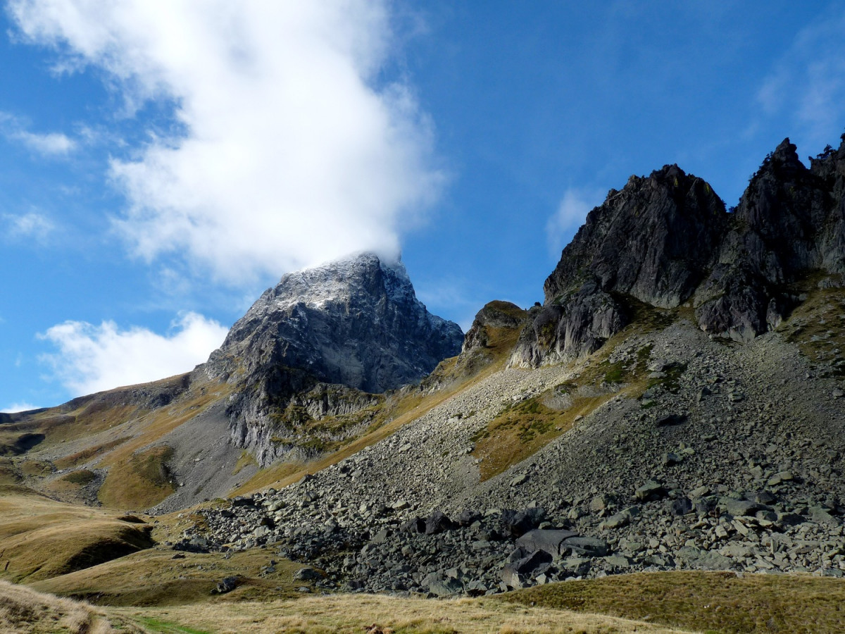
A must for experienced trail runners! This is a magnificent route where the lakes of Bious-Artigues, Roumassot, Gentau, Ayous and Pombie surround the legendary Pic du Midi d'Ossau.
The characteristics of the route.
Fabrèges (64)
- Distance 36.7 km
- Elevation gain 2060 m
- Elevation lost 2060 m
- Min. elevation 1242 m
- Max. elevation. 2192 m
- Duration (depending on pace) 7h30 à 15h
You may notice differences between the distance and elevation data displayed on the digital tools and the pdf file due to different data sources.
Report a problem 1 comment
PDF - Tour du pic du Midi d'Ossau
Add your time and share your feelings
Services nearby
Artouste charging station
Artouste

Restaurant Le Panoramic
ARTOUSTE

L'Estibère
GABAS
Hébergement associatif Béarn Pont de Camps
PONT-DE-CAMPS
Refuge de Pombie
COL-DU-POURTALET


Follow us on
the digital trails
the digital trails


![]()
The Ossau Valley Tourist Office
Welcome desk of Laruns
Maison de la Vallée d’Ossau – 64 440 LARUNS
+33(0)5 59 05 31 41
Tourist Office


OK
Annuler