Show the map
Col du Goulet - Les Ripellets - Avalon
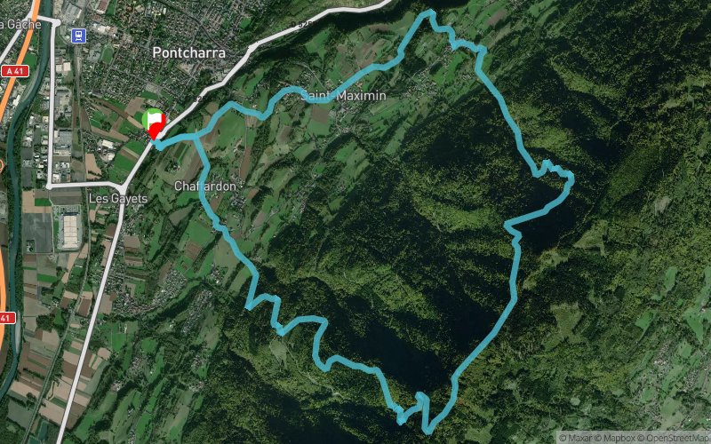


15.8 km
1060 m
1050 m
 Pontcharra (38)
 Points of Interest table
| Accum. | Intermediary | |||||||
|---|---|---|---|---|---|---|---|---|
| POI | Description | Alt. | Dist. | D+ | D- | Dist. | D+ | D- |
Trace n°55622
Ascent threshold : 1 m Distance threshold : 30 m Smoothing : Yes Origin of altitudes : MNT Aster GDEM
Ascent threshold : 1 m Distance threshold : 30 m Smoothing : Yes Origin of altitudes : MNT Aster GDEM
Loop
Dominant terrain : Path
Max alti. : 1208 m
Avg alti. : 668 m
Min alti. : 261 m
Longest ascent : 970 m
Longest descent : 950 m
Route completed by the author : nc
Dominant terrain : Path
Max alti. : 1208 m
Avg alti. : 668 m
Min alti. : 261 m
Longest ascent : 970 m
Longest descent : 950 m
Route completed by the author : nc
Elevation profile
More tools
Create a new roadbook page
Map and track on your website
Warning ! When you insert a Trace de Trail map on your website, you agree not to hide any element of the module (links to Trail Trail or Trail Connect banner)
Add a realisation
Validate
Add a realisation to share your chrono and describe the conditions that you encountered during you trail running !
Add a comment
Validate
Olivier_F95
22/01/23, 11:48:10
Parcours testé en hiver. La remontée du ruisseau du Tapon au dessus de la piste forestière est impossible (branchage, plaque de glace,...). Demi-tour obligé ?
22/01/23, 11:48:10
Parcours testé en hiver. La remontée du ruisseau du Tapon au dessus de la piste forestière est impossible (branchage, plaque de glace,...). Demi-tour obligé ?
Show the infos
Add a track