Show the map
Lyon - St Cyr au Mont d Or : sortie longue 1
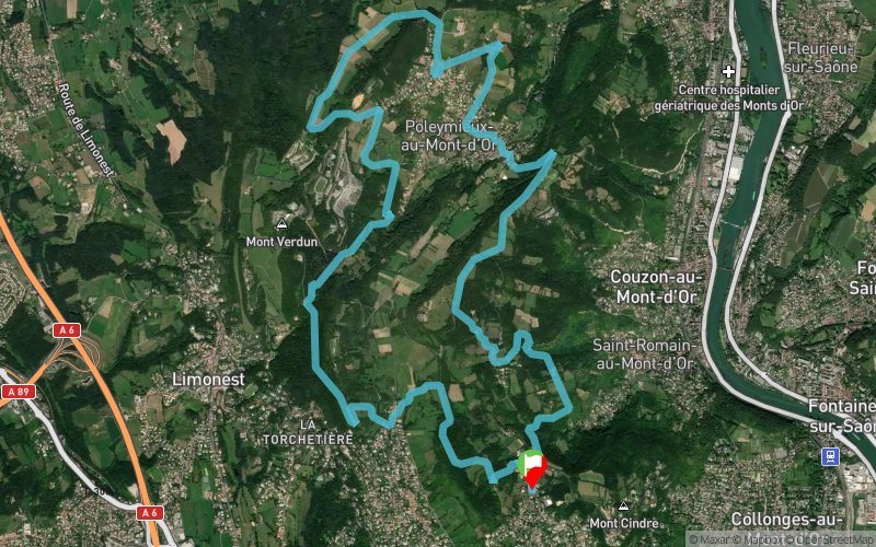


19.6 km
1140 m
1140 m
 Saint-Cyr-au-Mont-d'Or (69)
 Points of Interest table
| Accum. | Intermediary | |||||||
|---|---|---|---|---|---|---|---|---|
| POI | Description | Alt. | Dist. | D+ | D- | Dist. | D+ | D- |
Trace n°201510
Ascent threshold : 3 m Distance threshold : 30 m Smoothing : Yes Origin of altitudes : MNT Aster GDEM
Ascent threshold : 3 m Distance threshold : 30 m Smoothing : Yes Origin of altitudes : MNT Aster GDEM
Loop
Dominant terrain : Footpath
Max alti. : 595 m
Avg alti. : 396 m
Min alti. : 158 m
Longest ascent : 250 m
Longest descent : 280 m
Route completed by the author : Yes
Dominant terrain : Footpath
Max alti. : 595 m
Avg alti. : 396 m
Min alti. : 158 m
Longest ascent : 250 m
Longest descent : 280 m
Route completed by the author : Yes
Elevation profile
More tools
Create a new roadbook page
Map and track on your website
Warning ! When you insert a Trace de Trail map on your website, you agree not to hide any element of the module (links to Trail Trail or Trail Connect banner)
Add a realisation
Validate
Add a realisation to share your chrono and describe the conditions that you encountered during you trail running !
Add a comment
Validate
Fred73-
08/12/22, 20:00:04
Au plaisir de se croiser , j'ai actualisé le parcours initial avec la variante de la grimpette avant le Hameau du Mt Thou et du chemin des cabornes à l'arrivée à St Cyr.
08/12/22, 20:00:04
Au plaisir de se croiser , j'ai actualisé le parcours initial avec la variante de la grimpette avant le Hameau du Mt Thou et du chemin des cabornes à l'arrivée à St Cyr.
More comments
Show the infos
Add a track